By Gary Hengstler
After every disaster, emergency managers pose one question: What can be done better next time?
Yingie Hu, an assistant professor of geography at UT Knoxville, may have an answer. In his recent research, he proposed an algorithm for improving the efficiency of collecting geographic information after a disaster. With up-to-date information, response teams on the ground can make better informed decisions.
Hu’s work is based on the online disaster mapping platforms developed by the Humanitarian Openstreetmap Team. Hu and colleagues developed the algorithm to prioritize the areas that need detailed mapping first&emdash;focusing on the area’s road network, population distribution and degree of disaster severity.
Using the 2015 Nepal earthquake for a simulation, Hu said their algorithm prioritized the mapping grids within four hours. Their work was published in the journal Geographical Analysis. While initially designed for earthquakes, Hu’s work could also be applied to other disasters, such as wildfires.
“Collecting up-to-date geographic information is important,” he says, “ because after a disaster, no matter an earthquake or a fire, environment conditions may change. For example, previously there was a road but now it may not be accessible any more.”
Such prioritization is especially needed in situations where conditions can change rapidly. “Responders need to know not only which roads are their best routes, but also where the population most affected are,” he says.
Current online disaster mapping does not prioritize urgency, leaving volunteers to randomly choose areas in which to work. “My effort is to prioritize the cells needing the most help soonest,” he says.
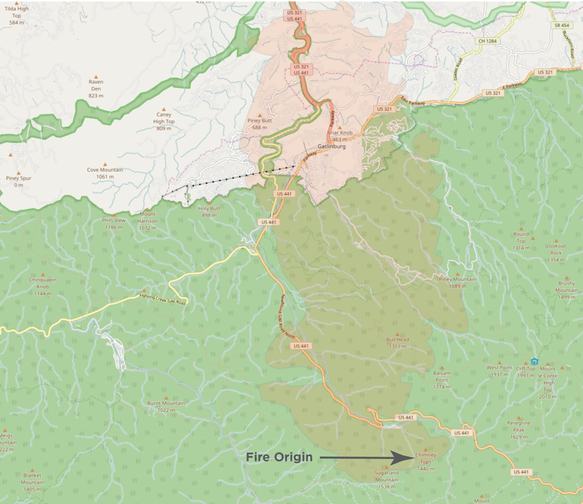
For now, Hu would like to partner with a humanitarian organization or disaster response organization locally for tests in advance of a future disaster such as the Gatlinburg fire.
“I’m looking for partners in this area from the information collectors to the disaster response teams. I hope to provide effective information to help the decision-makers and the disaster responders on the ground to get even more effective actions in the future.”